
Pin Parvati Pass Trek
A legendary high-altitude crossover trek through the breathtaking landscapes of Parvati Valley and Spiti, offering glaciers, alpine meadows, and an unforgettable Himalayan adventure.
Pin Parvati Pass Trek Overview
Why is Pin Parvati Pass a Must- Do Trek?
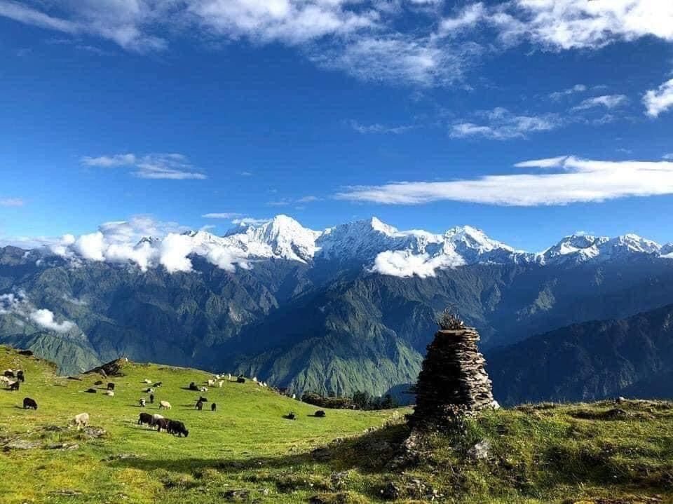
- The landscapes during the Pin Parvati Pass trek change from lush greenery of Parvati valley to the dry, colorful mountains of Spiti.
- During the trek you walk through forests, meadows, rocky paths, snowfields, and cold deserts all in one trek.
- The natural hot water spring at Kheerganga is a perfect place to relax before the tough journey begins.
- Camping in remote, scenic spots surrounded by high peaks and silence is an experience in itself.
- You get to visit the source of the Parvati River, a quiet and powerful moment in the lap of nature.
- The trek includes a few tricky sections where the trail isn’t always clear, but the trek leaders guide you through with care, turning challenges into an exciting part of the adventure.
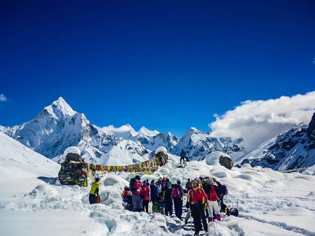
- Reaching the Pin Parvati Pass at 17,500 ft gives you amazing views of the two distinct valleys and a gushing feeling of success.
- Trek through beautiful landscapes filled with wildflowers, and keep an eye out for Himalayan wildlife like blue sheep (bharal), marmots, and ibex along the way.
- This trek challenges your body and mind, but the beauty, peace, and thrill make it truly worth it.
Major Attractions of the Pin Parvati Pass Trek
- Kheerganga: Kheerganga is one of the most peaceful halts on the Pin Parvati trek. It is well-known for its natural hot water springs that feel comforting after a long day’s walk. Many trekkers also come here separately for a short and beginner-friendly trek. Along with the soothing water, Kheerganga holds spiritual significance for many, which adds a quiet charm to the place.
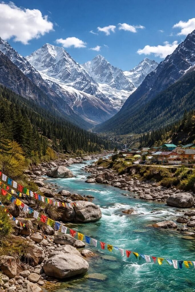
- Source of Parvati River: In the initial part of the trek, you walk alongside the Parvati river, listening to its loud, flowing rhythm. As you progress further into the trail, you eventually reach the source of this gushing river. Watching the river emerge from the high mountain slopes is a powerful and humbling experience.
- Challenging Sections: The Pin Parvati trek is more about its challenges, it demands focus and physical strength. Throughout the journey, you’ll face tricky stretches where the trail disappears into fields of boulders, narrow paths run beside deep gorges, and river crossings have to be done carefully, sometimes stepping over stones or holding onto ropes. These challenges may slow you down, but they also make the trek exciting and memorable.
- Pin Parvati Pass: Pin Parvati Pass is the highest and most awaited point of the trek. It marks the connection between the green Parvati Valley and the dry, cold Pin Valley. Reaching here is no small task, it comes after days of effort and patience. The wide, open view from the pass is not only beautiful but also makes you feel proud to have made it to the top.
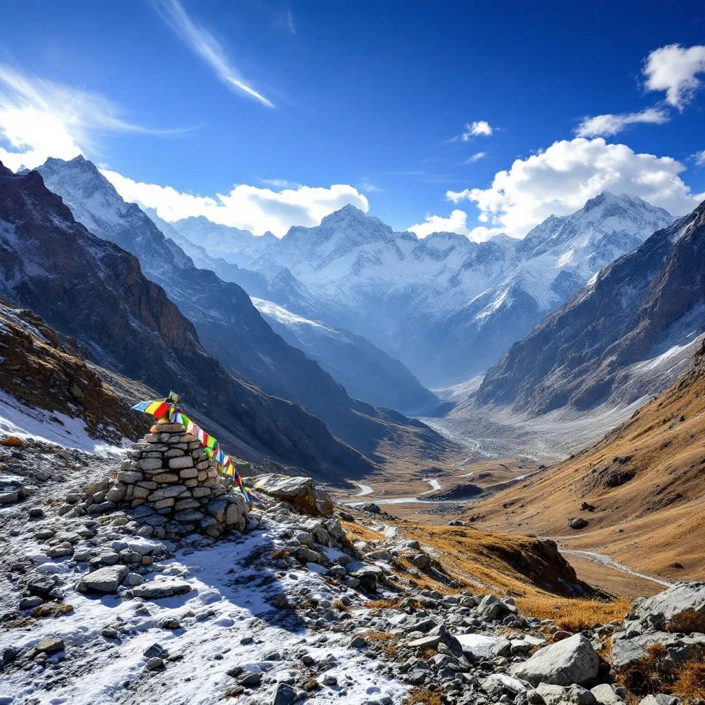
- Changing Landscapes: One of the most fascinating aspects of this trek is how beautifully the scenery changes around you. The trail begins in lush forests and green meadows where you walk under trees and beside streams. As you gain altitude, the greenery gives way to rocky terrain, snow patches, and a frozen high pass. Finally, you descend into the stark, dry landscape of Spiti, a true shift in nature that keeps the journey interesting from start to end.
- Cultural Diversity: The Pin Parvati trail also gives you a chance to experience different cultures along the way. At the beginning of the trek in Kalga and nearby villages, you come across traditional Himachali homes, wooden architecture, local fruits, and home-cooked meals. On the trail, you pass by shepherds who live with their flocks in the highlands. And once you cross into Spiti and reach the village of Mudh, you are welcomed by the warm and kind Bhotiya and Tibetan Buddhist locals.
Pin Parvati Pass Trek Itinerary
Day 1
Day 2
Day 3
Day 4
Day 5
Day 6
Day 7
Day 8
Day 9
Day 10
Day 11
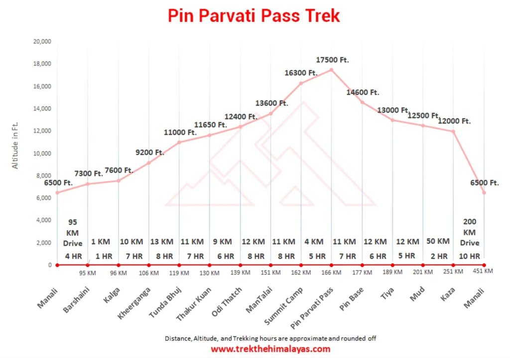
Manali to Barshaini and trek to Kalga
- Altitude(Kalga): 2300 m/ 7600 ft.
- Drive Distance(Manali to Barshaini): 4-5 hrs.
- Trek Distance( Barshaini to Kalga): 1 km | 1/2 hr.
Kalga to Kheerganga
- Altitude(Kheerganga): 2,800m/ 9,200ft.
- Trek Distance: 10 km | 6-7 hrs.
Kheerganga to Tunda Bhuj
- Altitude(Tunda Bhuj): 3,350 m/ 11,000 ft.
- Trek Distance: 13 km | 7-8 hrs.
Tunda Bhuj to Thakur Kuan
- Altitude(Thakur Kuan): 3,550 m/ 11,650 ft.
- Trek Distance: 11 km | 6-7 hrs.
Thakur Kuan to Odi Thach
- Altitude(Odi Thatch): 3,800m/ 12,400ft.
- Trek Distance: 9 km | 5-6hrs.
Odi Thach to Mantalai Lake
- Altitude(Mantalai): 4,150 m/ 13,600 ft.
- Trek Distance: 12 km | 7-8 hrs.
Mantalai Lake to Summit Camp
- Altiude(Summit Camp): 4,950 m/ 16,300 ft.
- Trek Distance: 11 km | 7-8 hrs.
Summit Camp to Pin Parvati Pass to Pin base/ Bedu Thatch
- Altitude: Pin Parvati Pass 5,300 m/ 17,450ft | PinBase( Bedu Thatch): 4,450m/ 14,600ft.
- Trek Distance:15 km | 10-12 hrs.
Pin Base to Tiya
- Altitude(Tiya): 3,950 m/ 13,000 ft.
- Trek Distance: 12 km | 5-6 hrs.
Tiya to Mud Drive to Kaza
- Altitude: Mud 3,750 m/ 12,500 ft | Kaza 3,650 m/ 12,000 ft.
- Trek Distance: 12 km | 4-5 hrs.
- Drive Distance(Mud – Kaza): 50 km drive 2 hrs.
Kaza to Manali
- Drive Distance(Kaza- Manali): 200 km | 9-10 hrs.
Note:
- Keep a buffer day in your travel plan.
- If buffer day is not used in the travel then it can be used to Explore Manali.
- Read the article Things to do in Manali.
- Distance, Altitude, and Trekking hours are approximate and rounded off.
- Keep the original and copy of ID proof handy.
- Come one day early if planning to come by flight.
Manali to Barshaini and trek to Kalga
- Altitude(Kalga): 2300 m/ 7600 ft.
- Drive Distance(Manali to Barshaini): 4-5 hrs.
- Trek Distance( Barshaini to Kalga): 1 km | 1/2 hr.
- Lunch at Manikaran (Stoppage for 1 hr).
- Leave Manali at 10 am.
- Bring left luggage separately so that without wasting time we will leave Manali on time.
- Networks are available at Kalga.
- Some parts of the trek through apple orchid.
- Stay in-home stay.
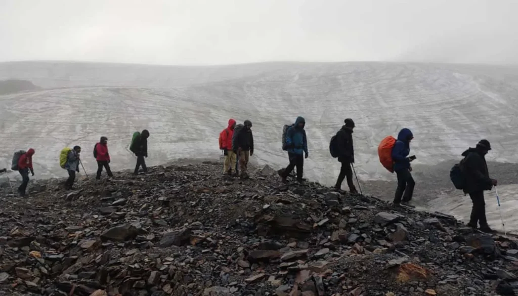
The adventurous journey of the trek will make a pleasurable trace when you reach Manali by 10 am in the morning and will leave for Barsheni Village which is surrounded by thick pine forest and green pastureland. Then further you will move to Kalga village which is a 1/2 hr trek from Barshaini. We will be taking a stop for lunch at Manikaran Gurudwara where you can visit the hot springs in the nearby premises. Hot langar is served at the gurudwara which you definitely need to try. After having our lunch we’ll head towards Barshaini from where we have a little trekking to do towards Kalga. Please note that there is a network available at Kalga and your accommodation will be in a guest house.
Kalga to Kheerganga
- Altitude(Kheerganga): 2,800m/ 9,200ft.
- Trek Distance: 10 km | 6-7 hrs.
- Altitude Gain: 500m/ 1,650ft.
- Stay in tents/ local rest houses.
- No Network available.
- Hot water spring at Kheerganga.
- Trek along with Parvati River.
- Will get many Maggi points on the way.
- Mixed forest of Pine, Oak, Horse chestnut, and Wall-nut.
- Less steep ascent, more gradual ascent.
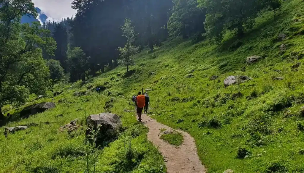
On the second day you will move to the long trail and continue from Kalga to move ahead and cross the bridge from here you can see River Parvati. Pin Parvati Pass Trek is a very enthralling experience to have fun while trekking and enjoy the enormous landscape view very closely. The trail goes through thick woodland cover and involves a sheer ascend of over 30 minutes.
The climb goes on till you arrive at a point from where it takes a rational V turn and you can see the restroom at your left. From here it takes another 10 minutes of walk up to a tending pastureland where Khirganga is. The last elongated side engrosses a long climb through a pine woodland area and you will come across a beautiful waterfall. You will also come across a maggie point where you can stop for some refreshment. The entire trail is less of a steep ascent and more of a gradual ascent which is a mixture of Pine, Oak, Horse chestnut and Walnut trees. Kalga to Khirganga is a 10km trek that takes approximately 6-7 hours. After reaching Khirganga your accommodation will be in tents.
Kheerganga to Tunda Bhuj
- Altitude(Tunda Bhuj): 3,350 m/ 11,000 ft.
- Trek Distance: 13 km | 7-8 hrs.
- Altitude Gain: 550 m/ 1,800 ft.
- Camp setup takes time due to the erratic availability of water, be patient.
- Gradual ascent but tiring.
- 3 small streams with small bridges be careful.
- No shops on the way.
- Last day of the forest.
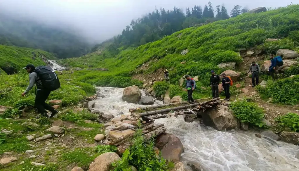
Today’s trek will start for Tunda-Bhuj which is a steady climb out and from there you can view the Parvati River coming down from the mountain’s left side. The track will move through long meadowland and the chirping of birds will give you gleaming happiness. The road from Khirganga is the first stream crossing starting with a constant ascent for about 20 minutes. Then you can see the temporary bridge over the edge of the mountains. There en route, you can see a small tent where the local wholesaler sells products. After 30 minutes you will walk out from the forest area and will see meadowland and the immense sight of the Dell. Now you will trail the high peak of the hill. Once you arrive at the top, the following will twirl within the hilly area and you see the huge area of the Parvati Valley in front. This will be the final overpass that you have to cross and you will reach Tunda-Bhuj situated at a high altitude of 11,000 ft above sea level. There you can see huge mountains covered with snow and the sight view looks very pretty.
Tunda Bhuj to Thakur Kuan
- Altitude(Thakur Kuan): 3,550 m/ 11,650 ft.
- Trek Distance: 11 km | 6-7 hrs.
- Altitude Gain: 200m/ 650ft.
- Most beautiful campsite of the trek.
- Tricky and rocky patch on the way so walking together is mandatory.
- After the tricky patch very steep ascent for 1 hr.
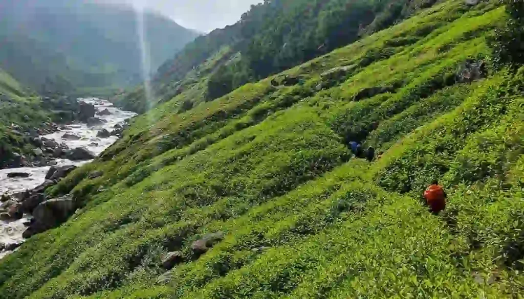
As walking down you will reach pastureland through an opaque mixed jungle with a profusion of lovely flowers and Greenery Island. The landscape view of Tunda Bhuj is very easy but the distance is somewhat tough as the bridge is very long to cross and time consuming. Crossing the bridge to the further side of the stream takes time to follow up the peak. It takes 15 minutes to reach the steady climb as you pass through an inclined rocky meadow land. Trekking in Manali discover the prettiness of lovely landscape views and enhance the beautiful picturesque. As you start for the further trail you will go upto a high level and the landscape view can be seen as very striking. After the early rise crossways the Pandu Bridge, walk down towards the Parvati River at your right takes 15 minutes to pass through the fields .Many shepherds can be seen with their group on the way. By evening time, you will reach the Thakur Kuan which is situated at a high altitude of 11,650- ft high above sea level.
Thakur Kuan to Odi Thach
- Altitude(Odi Thatch): 3,800 m/ 12,400 ft.
- Trek Distance: 9 km | 5-6hrs.
- Altitude Gain:250 m/ 750 ft.
- Easiest day of the trek.
- Pandu Bridge (The most tricky patch) comes just after 1.5 hrs of trek, to cross that bridge everyone has to be together.
- Most of the trail is flat walk.
- Water points are available before the Pandu Bridge
- Very windy campsite.
The next morning you will feel great after taking good rest as you have to get prepared for the adventures which lie ahead. As this is the easiest day of your trek it won’t take a huge toll on your body. You will cross the terrain region and then cross multiple streams coming your way. The day starts with a mild ascent followed by a slightly steep rise in the trail that will take you to the first river crossing. Further, you will find the Parvati River on the left part which looks very attractive. Then you will follow the big forest area and meadow land which can be seen aside from the Parvati River and enter the Thakur Kuan region which is surrounded by the pasture of orchard flowers and small trees. The Pandu bridge which is the most tricky patch comes after 1.5 hours of trek. It is recommended that all trekkers stay together in a group while crossing this natural bridge. This bridge is a natural formation created by huge boulders over the river. After crossing the adventurous Pandu Bridge, the trail is easy to walk as it is a flat ground that requires minimum effort. The trail spreads out in numerous directions as it is a shepherd trail. Remember to follow the group so that you do not get lost amid the labyrinth of trek routes. There are many water points before Pandu Bridge where you can refill your water bottles. After reaching Odi Thach we’ll be camping there for the night which is one of the windiest campsites. Odi Thach is a beautiful meadow with the majestic Mt. Kullu Eiger peak overlooking the meadow.
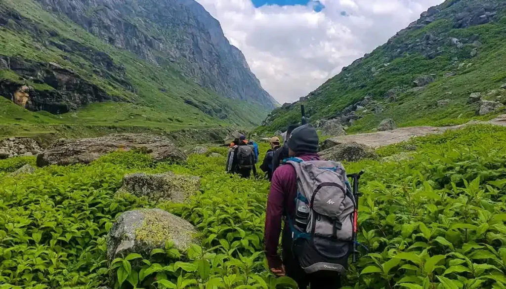
Odi Thach to Mantalai Lake
- Altitude(Mantalai): 4,150 m/ 13,600 ft.
- Trek Distance: 12 km | 7-8 hrs.
- Altitude Gain:- 350 m/ 1,200 ft.
- After half an hour from Odi Thach a big ground comes, and cross that ground from the left side (the ground is very muddy).
- Moraine area starts just after crossing that ground.
- The Moraine area is a steep ascent.
- Mantalai Lake is the source of the Parvati River.
- The small temple of lord Shiva at Mantalai Lake, from the temple campsite is 45 minutes away.
- Chances of getting AMS are high, keep yourself hydrated.
- Swimming in the lake is not allowed and not advisable.
Today, we’ll be covering a distance of 12k m which will take around 7-8 hours. This route is a bit muddy which at times can be slippery so it is important to be cautious. You will come across the moraine area which comes right after crossing the muddy surface. It has a steep ascent which requires a lot of physical energy to climb. So it is important to climb at your own pace. Mantalai Lake is the starting point of the Parvati River and you can also visit a small temple there. Your next campsite is just 45 minutes from here. The lake is at a higher altitude so there are chances of getting AMS. It is important to keep your body hydrated enough so that you are not hit by AMS.
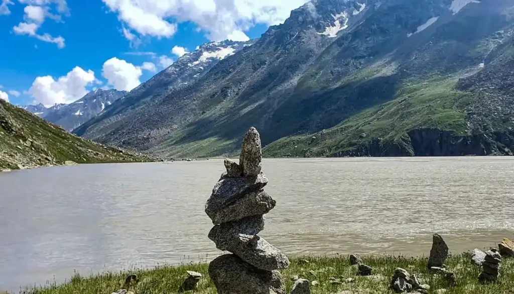
Mantalai Lake to Summit Camp
- Altiude(Summit Camp):4,950 m/ 16,300 ft.
- Trek Distance: 11 km | 7-8 hrs.
- Altitude Gain:- 800 m/ 2,700 ft.
- exhausted day.
- Most of the part is very steep ascent.
- Only two water points are available.
- Just after 30 to 40 minutes of trek first water stream comes, keep floaters handy.
- After 3 1/2 hrs one more stream crossing.
- Chances of missing is very high, never walk alone.
- Campsite is most uncomfortable, camping will be on rocks.
After leaving the striking place of Mantalai Lake you will cross the river lane which is a very hefty part of the trek and then you will walk through high rocky areas and glaciers. Then you will climb towards the right side of the slope, follow the trail which is very long and takes 9-10 hours. It takes around to climb the high mountain above at 14850 feet. Then you will walk to the campsite area, steep rocks will make you feel tired. Then you will reach to base camp which is surrounded by greenery everywhere and big glaciers. There you will stay in base camp and take rest for an hour and have a delicious dinner.
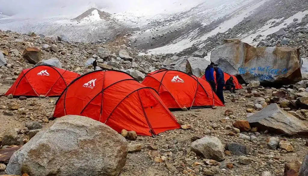
Summit Camp to Pin Parvati Pass to Pin base/ Bedu Thatch
- Altitude: Pin Parvati Pass 5,300 m/ 17,450ft | PinBase( Bedu Thatch): 4,450m/ 14,600ft.
- Trek Distance:15 km | 10-12 hrs.
- Altitude Gain:- 350m/ 1,150ft.
- Altitude Loss:- 850m/ 2,850ft.
- Stay on summit maximum for 15 to 20 minutes.
- Today don’t make your route on snow, always follow the trek leader or guide (craves area).
- Today’s descent is more tricky and tiring than ascent.
- One stream and one river crossing keep floaters handy and cross under the guidance of your trek leader.
- After river crossing the site is one hour away.
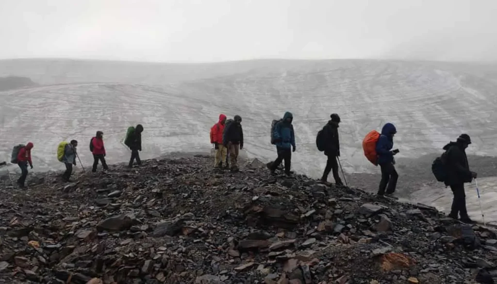
The trek begins another day after long hours of rest and after a long voyage you will then enter in Spiti Valley. The trail now climbs for an hour amid the glacier and a rock facade. After three hours of sturdy climbing you will arrive at the top of the pass at 17,500 feet from where you can look the way of Pin Valley towards Srikhand Mahadev. The follow come down over flurry and ice fields, covered with grasses and high rocks and stone will also come in your way. At this point, you will need to be very careful as there you will see very hefty paths which cross the dense forest lane and wild areas. The base camp is located in the centre of three vales. Moving further you can view the ranges of Dibibokri and Kulu Makalu which looks very fascinating and eye catchy as it is covered by large mountains and ice.
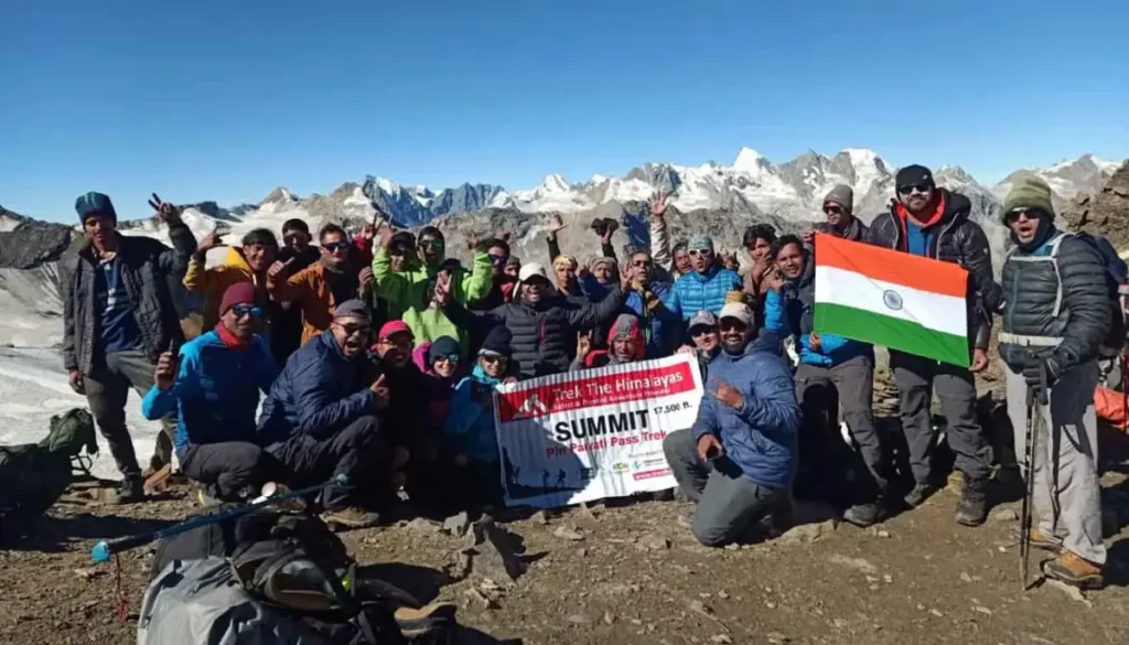
Pin Base to Tiya
- Altitude(Tiya): 3,950 m/ 13,000 ft.
- Trek Distance: 12 km | 5-6 hrs.
- Altitude Loss: 500 m/ 1,600 ft.
- Gradual descent.
- Very beautiful campsite and windy.
- Bearn land.
- Can see the Bhaba Pass route.
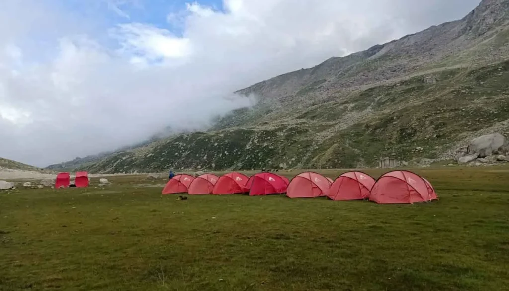
On this day will be trekking to Tiya which is approximately 12km. It is a gradual descent for most of the trek. It is a barren land which is surrounded by tall mountains. You will be able to see the trail of Bhaba Pass on this route. Your campsite at Tiya has a beautiful setting but it gets cold at night. It is important to have proper layering while you sleep in your tents.
Tiya to Mud Drive to Kaza
- Altitude: Mud- 3,750 m/ 12,500 ft | Kaza-3,650 m/ 12,000 ft.
- Trek Distance: 12 km | 4-5 hrs.
- Drive Distance(Mud – Kaza): 50 km drive 2 hrs.
- Altitude Loss:300m/ 1,000ft.
- Flat walk almost on the road.
- Trek till Mud and drive to Kaza.
- Due to no network transportation timing may get late.
- Stay in Kaza (Guest house).
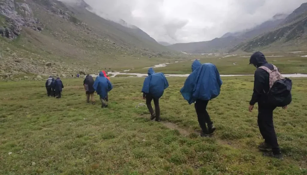
Today we’ll be trekking to Mud which is the last village of Pin Valley. It is a flat walk on the road almost on the road. After reaching Mud we will be driving to Kaza. Necessary arrangements will be made for your pick up after which we’ll be driving to Kaza. Your accommodation will be in a guesthouse at Kaza.
Kaza to Manali
- Drive Distance(Kaza- Manali): 200 km | 9-10 hrs.
- You’ll reach Manali between 6:00 pm and 7:00 pm.
- You can book your travel any time after 7:30 pm.
The way back to Manali will be by the familiar road, the drive starting at 6 You’ll reach Manali between 5:00 pm and 6:00 pm. You can book your travel any time after 7:30 pm.
Eligiblity for Pin Parvati Pass Trek
- Age Requirement:
- Minimum 18 years
- Experience of at least two high-altitude trek (4,500m- 5,000m) is required. First-timers are advised to avoid this trek.
- Fitness Criteria:
- The trekker should have sufficient stamina to cover 6 km of distance by jogging in 30 minutes without stress or 10 km of distance in 60 minutes without stress
- If the trekker prefers cycling he/she should be able to cycle 25 km of distance in 65 minutes.
- Trekkers must be able to carry a 10-15 kg backpack, as off-load options are not recommended.
- If a trekker’s BMI is more or less than the normal range (18-26), please consult our Trek Coordinator before booking.
- Pulse rate at rest must be in between (60 to 100 beats per minute).
- Blood Pressure Reading must be in between (DIASTOLIC 75 – 85, SYSTOLIC 100 - 130 mm Hg).
- Respiratory rate at rest must be in between (12 to 20 breaths per minute).
- Should not have Liver and kidney issues.
- Should not have Diabetes Mellitus, Bronchial Asthma, Heart problems, Hypertension, etc.
- No pacemaker implant.
- People with Sinus issues, Epilepsy please contact to trek coordinator before booking the trek.
- If your BMI is not normal, Please contact our Trek coordinator before Trek booking.
Must Watch Videos of Pin Parvati Pass Trek – Trek Guide & Virtual Tour
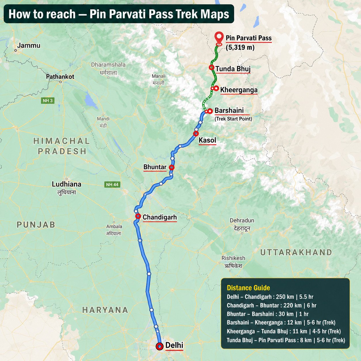
How to reach —Pin Parvati Pass Trek Maps
Pick Up Information
- Once you have reached the assembly point of the trek in Manali, TTH will manage the rest of your travel arrangements, if you have opted for TTH’s pick-up service, you can select this option during the booking process by adding it as an add-on.
Options to Reach Manali
First, you can arrive at Chandigarh, Delhi, Pathankot, or Bhuntar airport. The journey from these locations to Manali is explained below.
1. Take an overnight bus to Manali from Delhi or Chandigarh, taking a bus from Chandigarh is the most ideal option.
- Chandigarh to Manali Bus: 10 hours.
- Delhi to Manali Bus: 14 hours is hectic and takes more time.
( We strongly recommend going for the govt. Buses over the private ones outside the bus station as based on the experience we have found that there are very high chances of delay involved with private buses. Also, govt. Buses are always more reliable. Whichever bus you choose, just make sure to reach Manali at 10 am. )
2. You can take a flight to Bhuntar Airport (but we would not recommend it because of the high prices of the flight and very high chances of cancellations), Manali is just a couple of hours away and you can easily get a bus or a private taxi till there. If you do plan to come via Bhuntar, make sure to reach at least a day before the trek starts.
3. You can even come via train, Chandigarh railway station is from where you can get direct buses to Kullu/Kasol/Manali that is 275 km from there and would take an overnight journey. Even in this case, reach a day before at Manali.
( If you prefer to travel independently, you can either take a government bus or book a private cab. Your trek coordinator will provide guidance on how to arrange for the bus or cab booking.)
Drop-Off Information
- The designated drop-off point is the Woodbine Hotel in Manali around 6:30 pm to 7:30 pm .
- Please consider planning your subsequent travel arrangements after 8:00 pm.
- It’s highly advisable to keep a buffer day in your travel plan. If the buffer day is not needed, it can be used to explore Manali.
- TTH offers comfortable transportation through Tempo Traveler, Bolero, or equivalent vehicles. If you wish to upgrade your mode of transportation, please contact your trek coordinator for further assistance.
Pin Parvati Pass Trek Cost Terms – Inclusions & Exclusions
Inclusion
1. Accommodation (as per the itinerary):
- Guest house, Home Stay.
- Camping while the trek (Twin sharing basis).
2. Meals (Veg + Egg):
- Meals while on trek(Veg + Egg).
- Day 1 dinner to Day 10 pack lunch.
3. Support:
- 1 Versatile base camp manager: handles communication and deploys extra manpower in emergencies.
- 1 Mountaineering & First aid qualified professional trek Leader.
- 1 Experienced high-altitude chef.
- Local experienced guides (Number of guides depending on the group size).
- Enough support staff.
4. Trek equipment:
- Sleeping bag, Sleeping liners (if required), mattresses, and Utensils.
- 3 men all season trekker tent (twin sharing), Kitchen & Dining tent, Toilet tent.
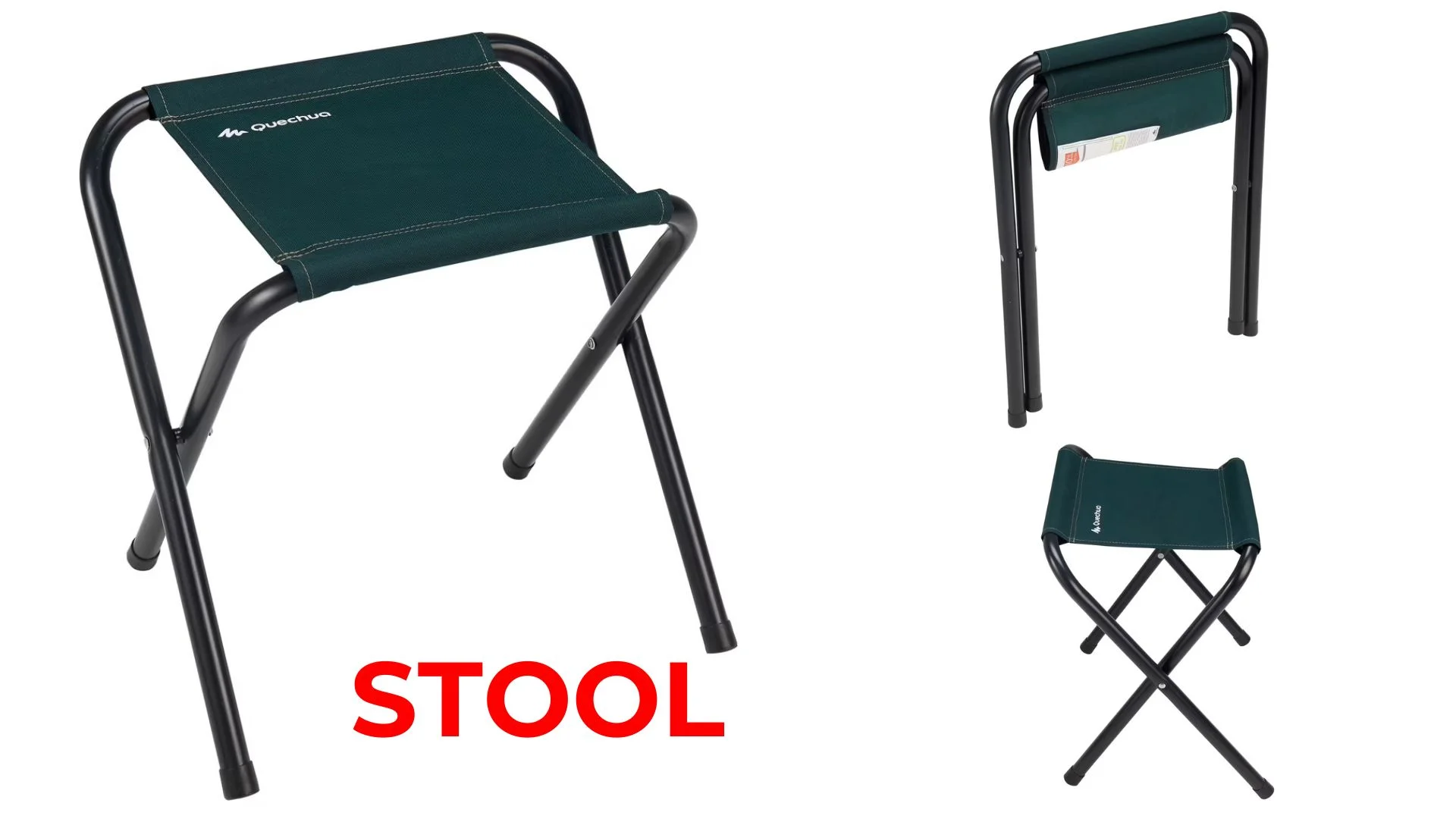
- Camping stool, Walkie talkie.
- Ropes, Helmet, Ice axe, Harness, Gaiters & crampons (if required).
5. First aid:
- Medical kit, Stretcher, Oxygen cylinder, Blood pressure monitor, Oximeter, Stethoscope.
6. Transportation (as per the itinerary):
- Transport till road head and return. (Manali to Barsheni and Mud to Kaza and Kaza to Manali, as per itinerary).
7. Mules/porters to carry the central luggage.
8. Cloakroom facility available at the base camp for additional luggage.
9. All necessary permits and entry fees, up to the amount charged for Indians.
10. Trek Completion Certificate.
Exclusion
- Insurance (Mandatory).
- Food during the transit.
- Any kind of personal expenses.
- Mule or porter to carry personal luggage.
- Emergency evacuation, hospitalization charge, etc.
- Any extra costs incurred due to extension/change of the itinerary due to natural calamities roadblocks, vehicle breakdown, etc. factors beyond our control
- Anything not specifically mentioned under the head Inclusion.
Things can be provided on demand and availability (participant has to pay extra for these things).
1- Satellite phone/set phone – is a type of mobile phone that connects via radio links via satellites orbiting the Earth instead of terrestrial cell sites like cellphones. Therefore, they can operate in most geographic locations on the Earth’s surface.
2- Gamow/PAC HAPO Bag (Portable Hyperbaric Bag) – is a unique, portable hyperbaric chamber for the treatment of acute mountain sickness (AMS), also known as altitude sickness.
3- AEDs (Automated External Defibrillators) – are portable life-saving devices designed to treat people experiencing sudden cardiac arrest, a medical condition in which the heart stops beating suddenly and unexpectedly.
Pin Parvati Pass Trek Essentials – Complete Packing List
| Item | Specification / Quantity |
|---|---|
| Backpack with Rain Cover | 50–60 L capacity with comfortable shoulder straps |
| Day Pack with Rain Cover | 20–30 L capacity (if off-load option is chosen) |
| Walking Stick | Advisable (at least 1) |
| Water Bottle / Hydration Pack | 2 × 1-liter water bottles or 1 hydration pack + 1 × 1-liter water bottle |
| Small Tiffin / Lunch Box | 1 piece |
| Snacks | Energy bars, dry fruits, Electral/ORS sachets |
| Personal Medical Kit | Carry medicines as advised by your doctor |
| Clothing Item | Specification / Quantity |
|---|---|
| T-Shirt (Synthetic Quick Dry) | 2 Full-sleeve & 2 Half-sleeve |
| Fleece T-Shirt | 1 piece |
| Fleece Jacket | 1 piece |
| Windproof Jacket | 1 piece |
| Down Feather / Hollow Jacket | 1 piece |
| Thermal Inner (Upper & Lower) | 1 pair |
| Trek Pant (Synthetic Quick Dry) | 3 pieces |
| Fleece Pant | Not required |
| Waterproof Gloves | Not required |
| Fleece / Woollen Gloves | 1 pair |
| Poncho / Waterproof Jacket & Pant | 1 set |
| Accessory | Specification / Quantity |
|---|---|
| Head Torch | 1 piece (Avoid hand torch) |
| Sun Cap | Not required |
| Woollen Cap | 1 piece |
| Balaclava | Not required |
| Buff / Neck Gaiter | 2 synthetic pieces |
| Sunglasses | UV-protected with dark side covers. If you wear spectacles: (A) Use contact lenses, or (B) Use photochromic glasses. |
| Footwear | Specification / Quantity |
|---|---|
| Trekking Shoes | 1 pair (Water-resistant, high ankle, with good grip) |
| Floaters / Flip-Flops | 1 pair |
| Cotton Socks | 7 pairs |
| Woollen Socks | 1 pair |
| Gaiters | 1 pair (Provided by TTH when required) |
| Micro Spikes | 1 pair (Provided by TTH when required) |
| Personal Care Item | Specification / Quantity |
|---|---|
| Sunscreen | 1 Nos |
| Moisturiser | 1 Nos |
| Chap-stick / Lip balm | 1 Nos |
| Toothbrush and toothpaste | 1 Nos |
| Toilet paper & Wipes | 1 Nos |
| Soap / hand sanitizers | 1 Nos |
| Antibacterial powder | 1 Nos |
| Quick dry towel | 1 Nos |

Cancellation Terms
To request a cancellation, please email us at info@call9adventures.com using your registered email ID.
Cancellations prior to 25 days from the start of the Trip.
Refund Options
- 5% deduction of trek fee
- 100% trek fee cash voucher for any trip till one year
- Transfer your trek (any trek, any date) to your friend
Cancellation between 14 days and 10 days to the start of the Trip
Refund Options
- 50% deduction of trek fee
- 80% trek fee cash voucher for same trip till one year
- 70% trek fee cash voucher for any trip till one year
- Book the same trek, in the same season, with any other batch
- Transfer your trek (same trek, any date) to your friend
Cancellation less than 9 days to the start of the trek.
Refund Options
- No cash refund
- 20% trek fee cash voucher for the same trip till one year
- 10% trek fee cash voucher for any trip till one year
- Transfer your trek (same trek, same date) to your friend
- To reschedule a trek (same trek only), a 30 % rescheduling fee of the trek cost will apply.
Cancellation Policy (Emergency Cases):
In case of a death in the immediate family (parents, siblings, spouse, children) or if the trekker is hospitalized (min. 48 hours) or suffers a fracture (leg/arm) within a week before the trek, even if canceled a day before:
90% trek fee refund in cash & 10% as a voucher (valid for 1 year, for any India trek).
Valid documents required. We’re here to support you during tough times.
Note:
- Change of trek batch is dependent on the availability of seats in the batch
- In case of transferring a trek to a friend, he/she should satisfy all the mandatory requirements put forward by TTH
- TTH holds the right to change/cancel the policies, without prior notice
Booking and Payments
- The Participant is responsible for verifying the accuracy of all details, including Trip dates and personal documentation, at the time of booking.
- Payments must be made in accordance with the timelines and instructions provided by TTH. Late payments may result in cancellation of booking without refund.
- In the event of a cash refund, only the portion of the payment made in cash shall be eligible for refund in cash. Any booking made using voucher, discounts, promotional codes, or through any non-cash mode of payment shall not be eligible for a cash refund under any circumstances.
- Refunds, if applicable, shall be processed within 15–30 working days of confirmation.
- All add-on bookings are subject to the respective add-on cancellation policy, and refunds will be processed accordingly.
- Voucher Terms
- This is a non-transferable voucher
- The voucher cannot be merged with any other offer of Trek The Himalayas
- The voucher is valid for Trek booked directly with Trek The Himalayas in India
- To avail the voucher please use your register phone number or e-mail id
- All the other Terms of booking a trek with Trek The Himalayas are applicable to the voucher
Itinerary and Modifications
- TTH reserves the right to modify, shorten, or cancel any part of the Trip due to transportation delays, weather, health emergencies, or other unforeseen circumstances including Force Majeure.
Cancellations and Refunds
- No refunds or vouchers, partial or otherwise, shall be provided for voluntary withdrawal, non-utilisation of services, or removal from the Trip.
- If TTH cancels the Trip before arrival at the designated pick-up point due to unforeseen circumstances or Force Majeure, the Participant may choose from:
- An alternate Trip/date.
- A credit voucher valid for one (1) year.
- Transfer to another Trip, with cost differences payable by the Participant.
- If the Trip is abandoned post-arrival at the designated pick-up point, no cash refund or voucher shall be issued. The Trek Again Policy may apply at TTH’s discretion.
- TTH shall not be liable for any associated travel costs such as flights, accommodation, or visa fees.
Force Majeure
- Events beyond its control including but not limited to earthquakes, landslides, strikes, curfews, war, pandemic, government restrictions, heavy rainfall or snowfall, windstorms, road blockages, trail disruption, or withdrawal of permits, TTH shall not be held liable for any cancellation, delay, or service modification caused by Force Majeure.
Government employees can avail the benefit of Special Casual Leave (SCL) when they join us for a trekking expedition. As per Pay Commission guidelines, up to 30 days of Special Casual Leave can be availed in a calendar year for trekking or mountaineering expeditions conducted through a registered organisation.
Trek The Himalayas is a registered adventure tour operator with the Indian Mountaineering Foundation (IMF) and the Ministry of Tourism (MoT), making your trek eligible for SCL benefits.
To apply, email us at info@call9adventures.com at least 30 days before the trek departure date, with the following details:
- Trek name and trek date
- Booking details
- Full name
- Designation
- Department and department address
This benefit is exclusive to Indian Government employees and is applicable only for treks within India.
- Junior trekkers (below 15 years) should have a company of parents/guardians.
- Trekkers between 15 to 18 years can come solo with the disclaimer form signed by parent/guardian.
- Medical & Disclaimer Form (Mandatory Documents)
Mandatory Documents to Bring on A Trek
Pin Parvati Pass Trek Frequently Asked Questions (FAQ)
The toughest trek in India is the Pin Parvati Pass Trek in Himachal Pradesh. It is considered the most difficult because of its long trekking distance each day, high altitude, and challenging terrain. Other similar tough treks include Auden’s Col, Kalindi Khal, and Panpatia Col in Uttarakhand. Slightly less difficult, but still challenging, are Bali Pass and Kedartal in Uttarakhand, and Goechala in Sikkim. All of these treks require good fitness, preparation, and experience in the mountains.
The Pin Parvati Pass trek takes around 11 days to complete, including acclimatization and buffer days. Spread over this duration, trekkers cover various terrains, ranging from dense forests and alpine meadows to rocky mountain passes and glacier sections. It’s a well-paced itinerary that allows you to gradually adjust to the altitude and enjoy the journey fully.
The highest point of the trek is the Pin Parvati Pass, which stands tall at around 17,400 feet (5,300 meters). This is where the trek transitions from the lush Parvati Valley to the stark, cold desert landscape of Pin Valley in Spiti. Reaching this altitude requires proper acclimatization and good physical fitness.
The total trekking distance is approximately 110 kilometers, spread across 10–11 days. The route begins in Parvati Valley (Kullu side) and ends in Pin Valley (Spiti side), taking you through an incredible shift in landscape, from green forests and waterfalls to barren, high-altitude desert. Each day covers roughly 8–15 km depending on the terrain and campsite location.
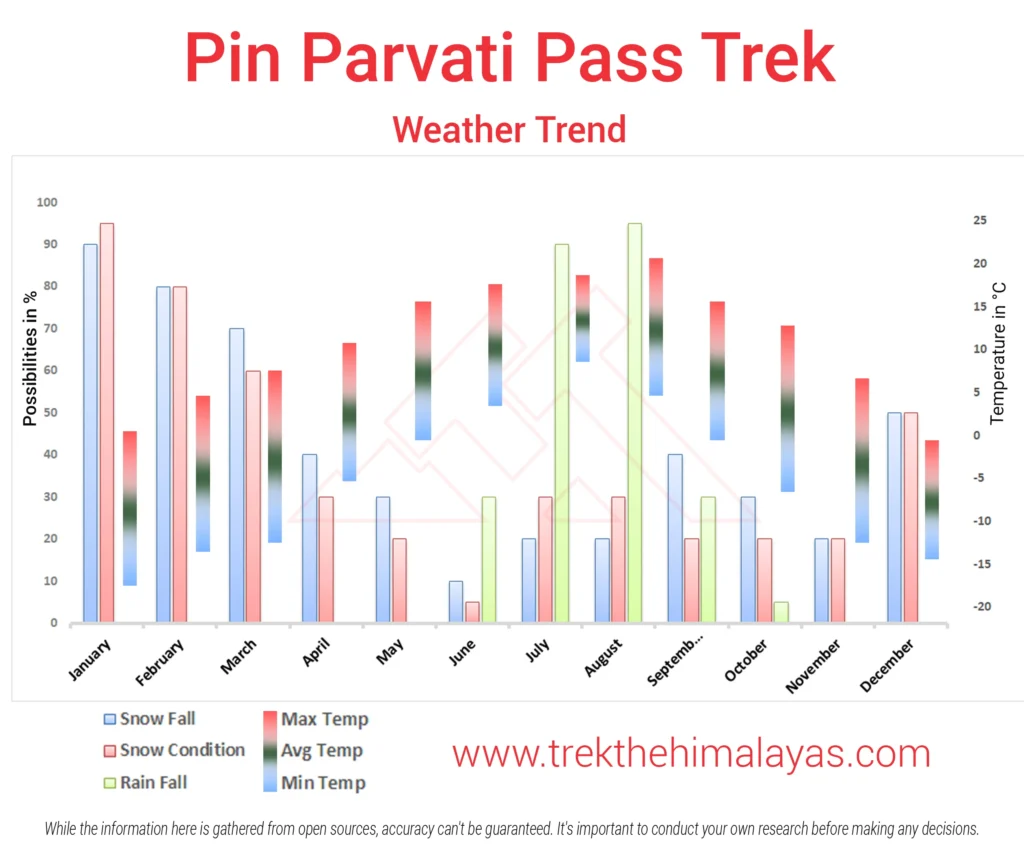
The best time to do the Pin Parvati Pass trek is during the monsoon months, specifically mid July to mid- August. During this time, the snow at higher altitudes begins to melt, making the pass more accessible. The valleys are lush and blooming with greenery, rivers are full, and the skies, though sometimes cloudy, offer dramatic views. The temperatures are relatively moderate, which makes trekking long hours more manageable. However, it’s important to stay updated on weather conditions, as rain in lower regions can sometimes affect the trail.
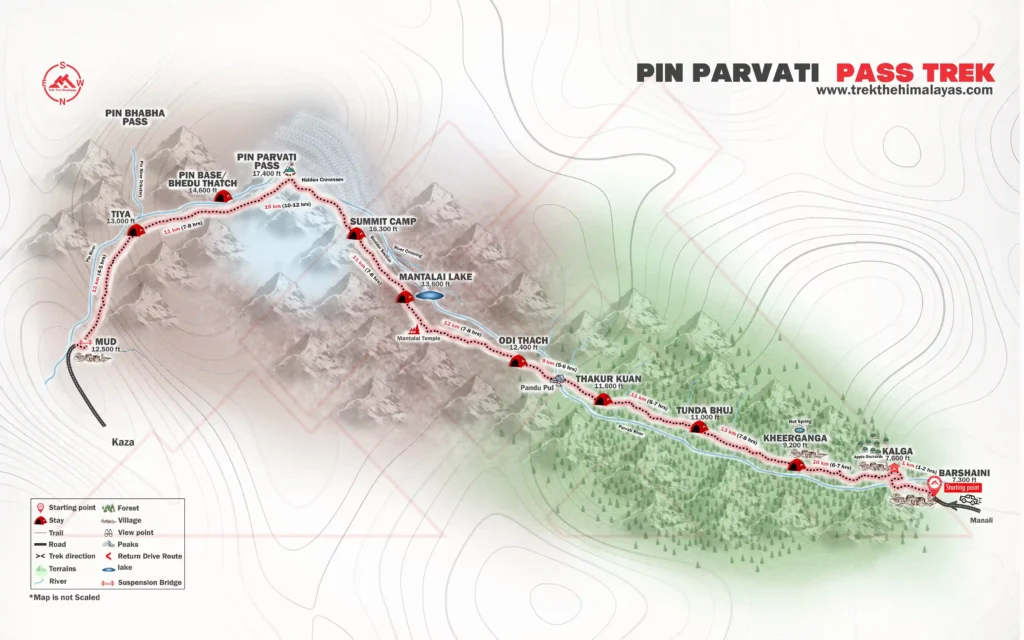
The Pin Parvati Route and Pin Parvati Pass Trek Itinerary is as follows:
Day-1: Manali to Barshaini and trek to Kalga
Day-2: Kalga to Kheerganga
Day-3: Kheerganga to Tunda Bhuj
Day-4: Tunda Bhuj to Thakur Kuan
Day-5: Thakur Kuan to Odi Thach
Day-6: Odi Thach to Mantalai Lake
Day-7: Mantalai Lake to Summit Camp
Day-8: Summit Camp to Pin Parvati Pass to Pin base/ Bedu Thatch
Day-9: Pin Base to Tiya
Day-10: Tiya to Mud Drive to Kaza
Day-11: Kaza to Manali
The trek package is designed to provide a well-organised and comfortable journey, ensuring that every trekker can enjoy trekking without worrying about the logistics. The package includes accommodation throughout the journey, offering comfortable stays at different points of the trek.
Meals and all necessary transportation is covered, including drives to and from key locations.
For the trekking experience, the package provides high-quality trek equipment, ensuring safety and comfort during the journey. A well-equipped first aid kit is also included, along with medical assistance in case of emergencies. To make the trek smoother and more enriching, a dedicated support team accompanies travelers. This team includes experienced local guides who are familiar with the region, a base camp manager to oversee logistics, and a professional trek leader to ensure safety and coordination throughout the journey. With all these inclusions, the package is designed to offer a hassle-free, safe, and memorable experience for every trekker.
Click here to check the Pin Parvati Pass trek cost.
The Pin Parvati Pass Trek is graded as a challenging trek and known to be one of the most difficult treks in India. It takes you to very high altitudes, where the chances of altitude mountain sickness (AMS) are quite high if you are not properly acclimatised. The trail includes steep ascents, tricky descents, river crossings with strong currents, and long stretches of walking on glaciers and rocky terrain. The path is often uneven and rough, demanding your full focus at every step. Campsites get colder and windier as you go higher, which can be tough for those not used to such conditions. This trek is physically and mentally demanding, and it is recommended only for trekkers who have previous high-altitude trekking experience.
The Pin Parvati Pass Trek starts from a small village called Barshaini, which is located near Kasol in Himachal Pradesh. To reach Barshaini, you need to first get to Manali, and from there it’s a drive of around 4 to 5 hours through beautiful forested and mountainous roads. Barshaini is the last motorable point and marks the beginning of your trek into the wilderness of the Himalayas.
The Pin Parvati Pass Trek takes you through two stunning valleys, Parvati Valley and Pin Valley. Parvati Valley, on the Kullu side, is lush green and filled with forests, meadows, and rivers. As you cross the high-altitude pass, you enter the stark and dry landscape of Pin Valley in Spiti, which is a complete contrast with its barren mountains and colorful rock formations. These two valleys show you completely different sides of the Himalayas.
During the Pin Parvati Pass Trek, you will stay in homestays and tents. On the first day, you’ll rest at a homestay in Kalga, a quiet and scenic village. From the next day, you will camp at beautiful and remote locations. Tents are usually for two people, and sleeping bags and mats are provided. Camping close to nature, under the stars, makes the trek even more special. After the trek ends, you’ll return to a guesthouse to relax before heading back.
No, the Pin Parvati Pass Trek is not recommended for beginners. This is a high-altitude and highly demanding trek that requires good physical fitness and prior experience in multi-day Himalayan trekking. It includes steep climbs, river crossings and rough terrain. First-timers are advised to start with easier treks before attempting this one.
The last reliable ATM is in Manali. It is recommended to withdraw enough cash here for the entire duration of your trek, as you won’t find any ATMs beyond this point.
No, there is no electricity or charging facility available during the trek. Make sure to fully charge all your devices in Manali, and carry extra batteries or power banks to stay covered throughout the journey.
Yes, you can safely leave your extra luggage at a designated storage facility in Manali, before you begin trekking for the Pin Parvati Pass.
Yes, offloading services are available on this trek. If you're not comfortable carrying your backpack for long hours, you can hire a porter to carry your load. This makes the trek easier and allows you to enjoy the trail without added physical strain, especially at high altitudes.
To do the Pin Parvati Pass Trek, you should have experience of at least two high-altitude treks ranging between 4,500m to 5,000m. This is a difficult and demanding trek, not suitable for beginners. First-time trekkers are strongly advised to avoid this trek and build experience on easier trails first.
The Pin Parvati Pass Trek is packed with stunning and memorable highlights, such as:
- Dramatic change in landscapes – from lush green forests to barren Spiti desert.
- Crossing the Pin Parvati Pass – the thrilling and highest point of the trek.
- Kheerganga’s natural hot springs – a relaxing treat in the middle of the wild.
- Challenging terrain – glacier walks, river crossings, boulder sections and long trekking hours.
- Rich cultural and natural diversity – experience the contrast between the lively Parvati Valley and the remote Pin Valley.
Yes, it is highly recommended to keep 1–2 buffer days while planning your travel. Since this is a monsoon trek, roads like the Chandigarh–Manali highway are often affected by landslides or delays. It's a good idea to reach Manali a day early and also keep an extra day for your return. These buffer days will give you peace of mind and help you avoid any last-minute stress in case of unexpected delays.
Yes, someone over 60 can join the trek, but only if they meet the required fitness level. Since this is a tough high-altitude trek, it’s very important to be physically prepared. Please make sure to connect with the trek coordination team before booking, so they can guide you properly and assess your suitability for the trek.
Yes, there are technical sections in the Pin Parvati Pass Trek. You would need to use ropes, harnesses, crampons, and spikes to safely cross tricky areas, especially while crossing glaciers, rocky or steep sections. Your trek leaders will guide and support you, but having some basic knowledge of how to use these gears can be helpful.
Himachal has many beautiful treks to choose from. Some of them include Pin Bhaba Pass Trek, which is quite similar in beauty to Pin Parvati but less demanding. Other options are Rupin Pass, Buran Ghati, Hampta Pass, Friendship Peak Expedition, and Yunam Peak Expedition.